

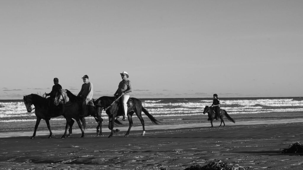
Trail riding and navigation combine outdoor adventure with the technical skills of finding your way through wilderness areas. Whether on horseback, bicycle, ATV, or motorcycle, navigating trails effectively ensures both safety and enjoyment of the natural environment. The art of trail navigation riding goes beyond simply following marked paths—it involves understanding terrain, reading natural indicators, using navigation tools, and preparing for unexpected situations. This comprehensive guide will equip both beginners and experienced outdoor enthusiasts with essential knowledge to confidently explore trails while minimizing risks and maximizing the experience.
Understanding the Basics of Trail Navigation

Trail navigation is fundamentally about knowing where you are, where you’re going, and how to get there safely. Before venturing into any trail system, riders should familiarize themselves with the basic concepts of navigation including cardinal directions, map reading, and landmark identification. Understanding elevation changes through topographic map interpretation can help predict the physical demands of a route. The ability to triangulate your position using multiple reference points is another critical skill that forms the foundation of successful trail navigation. These skills become particularly valuable when trails become unclear or when riders venture into less-traveled areas.
Essential Navigation Tools for Trail Riders

Every trail rider should assemble a reliable set of navigation tools before heading out. Physical maps of the specific trail system are non-negotiable basics that don’t require batteries or signal. A quality compass serves as the most reliable directional tool and requires minimal training to use effectively. GPS devices or smartphone applications with downloadable offline maps provide digital precision but should never be solely relied upon. Altimeters help track elevation changes and can assist in confirming locations on topographic maps. Remember that redundancy in navigation tools is not excessive—it’s a safety measure that ensures you can find your way even if one system fails.
Map Reading Skills for Trail Navigation
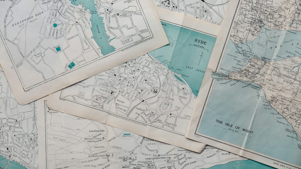
Proficient map reading forms the cornerstone of trail navigation riding. Understanding map legends, scale, and symbols allows riders to accurately interpret distances, terrain features, and available facilities. Topographic maps reveal three-dimensional terrain through contour lines, helping riders anticipate steep climbs, descents, and potential hazards. Learning to orient a map to match your surroundings (known as “setting the map”) creates an intuitive connection between the paper representation and the actual landscape. Regular practice with maps before critical situations arise ensures that riders can confidently use them when navigation becomes challenging or when familiar landmarks disappear from view.
Using GPS and Digital Navigation Apps

Modern trail navigation has been revolutionized by GPS technology and specialized apps designed for outdoor adventure. These digital tools offer precise location data, can record tracks for future reference, and often include features like emergency alerts and weather updates. Apps such as TrailForks, AllTrails, and Gaia GPS provide detailed trail information, including user reviews, difficulty ratings, and points of interest. Before departing, riders should download offline maps for their intended route as cellular service is frequently unavailable in remote areas. While embracing these technological advantages, wise riders maintain proficiency with traditional navigation methods as electronic devices can fail due to battery depletion, physical damage, or software glitches.
Reading Natural Navigation Signs

Before the invention of modern navigation tools, travelers relied on natural indicators to find their way. The sun’s position provides reliable directional information, rising in the east and setting in the west. In the Northern Hemisphere, moss often grows more prolifically on the north side of trees and rocks due to increased moisture and shade. Star navigation, particularly locating the North Star (Polaris), offers nighttime directional guidance. Certain regional plants and geological features can also provide clues about cardinal directions, water sources, and upcoming terrain changes. While these natural navigation techniques shouldn’t be your primary method, they provide valuable backup knowledge when other systems fail.
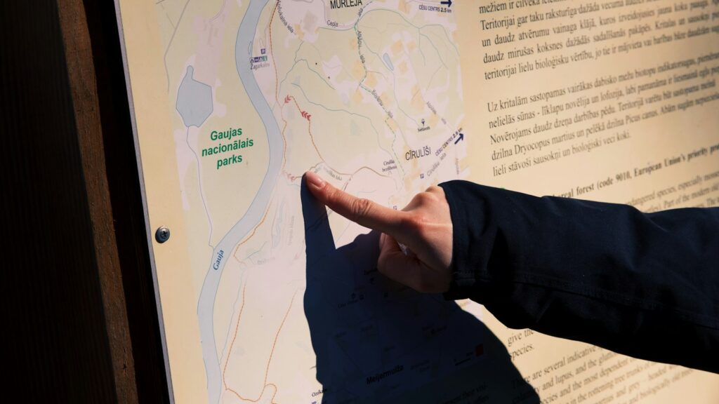
Trail Marking Systems and How to Interpret Them

Trail systems employ various marking conventions that riders should understand before setting out. Common marking methods include colored blazes painted on trees, plastic or metal markers attached to posts, cairns (stacked rocks) in alpine areas, and signposts at trail intersections. Different colors or symbols often indicate trail difficulty, permitted uses, or connect to specific routes within a network. International trail systems may use standardized symbols that transcend language barriers, particularly in popular tourist destinations. Familiarizing yourself with the specific marking system used in your riding area prevents wrong turns and keeps you on trails appropriate for your skill level and vehicle type.
Planning Your Route Effectively

Successful trail navigation begins long before the ride with thorough route planning. Start by researching the trail area through guidebooks, online resources, and local riding clubs to understand distances, difficulty levels, and points of interest. Calculate realistic timeframes based on your riding speed, terrain challenges, and necessary rest breaks. Identify potential bailout points where you can exit the trail system if weather, mechanical issues, or emergencies necessitate cutting the ride short. Share your detailed route plan with a reliable contact not on the ride, including expected return time and instructions on when to alert authorities if you don’t check in. This pre-ride preparation creates a safety net and allows you to focus on enjoying the experience rather than making stressful decisions on the trail.
Weather Considerations for Trail Navigation

Weather conditions significantly impact trail navigation and riding safety. Sudden storms can reduce visibility, transform dry trails into muddy hazards, and create dangerous water crossings. Checking detailed weather forecasts specifically for your trail area is essential, particularly noting wind direction, precipitation probability, and temperature changes. Different seasons present unique challenges: summer brings potential for dehydration and lightning storms; winter introduces snow cover that can obscure trail markers; spring often features muddy conditions and high water levels. Understanding how weather affects both the physical trail conditions and your navigation tools helps you make prudent decisions about when to proceed, when to take alternate routes, and when to postpone rides entirely.
Night Navigation Techniques

Navigating trails after dark requires specialized skills and equipment to ensure safety. Powerful, reliable lighting systems appropriate to your riding vehicle are non-negotiable for night rides, preferably with backup options in case of primary light failure. Reflective trail markers become invaluable after sunset, so familiarize yourself with how they appear when illuminated by your lights. Night vision adapts better when using red-filtered lights for map reading and close-up tasks, preserving your ability to see the trail ahead. Psychological factors also come into play—familiar trails often seem different at night, and distance perception can be compromised, making it wise to practice night navigation on well-known routes before attempting unfamiliar territory after dark.
Emergency Navigation When Lost

Even experienced trail riders can become disoriented or lost, making emergency navigation knowledge essential. The STOP principle (Stop, Think, Observe, Plan) provides a structured approach to regaining your bearings without panicking. Retracing your path to the last known location often proves more effective than continuing in uncertainty. Prominent natural features like ridgelines, rivers, or power lines can serve as handrails to guide you toward civilization or known points. In true emergencies, understanding how to signal for help using whistles, mirrors, or bright fabrics increases your chances of being located by search parties. Carrying emergency shelter, extra food, water purification, and fire-starting tools provides critical support while implementing your emergency navigation plan.
Navigating Different Terrain Types

Each terrain type presents unique navigation challenges requiring specific techniques. Desert landscapes with minimal distinguishing features demand precise compass work and attention to subtle landscape changes. Densely forested areas obstruct distant landmarks, making frequent map checks and compass bearings necessary to maintain course. Alpine environments above treeline offer excellent visibility but expose riders to rapidly changing weather conditions and routes that may disappear under snow. Wetland areas require careful mapping to distinguish between seasonal and permanent water bodies that might block passage. By understanding the navigation peculiarities of each environment, riders can adapt their techniques and equipment selections to maximize efficiency and safety.
Group Navigation Strategies
Riding in groups introduces special considerations for effective trail navigation. Designating primary and backup navigators ensures navigation responsibilities don’t fall solely on one person. Regular group stops at trail intersections prevent separated riders from taking different paths. Communication protocols using whistles, hand signals, or radio devices help maintain group cohesion when visual contact is broken. The “buddy system” pairs riders to account for everyone’s safety, particularly important in larger groups where it’s easy to lose track of individuals. While group riding offers enhanced safety through shared resources and knowledge, it requires explicit coordination to ensure navigation decisions are clearly communicated and understood by all participants.
Navigation Ethics and Trail Stewardship

Responsible trail navigation includes ethical considerations that preserve the environment and maintain positive relationships with other outdoor enthusiasts. Staying on designated trails prevents habitat destruction and soil erosion that can permanently damage delicate ecosystems. Respecting private property boundaries by carefully observing map notations and signage avoids trespassing issues. When nature calls, implementing Leave No Trace principles for human waste and packing out all trash maintains the wilderness experience for future visitors. Accurate reporting of trail conditions, hazards, or marker damages to land management agencies contributes to the maintenance of trail systems for everyone’s benefit. Ethical navigation demonstrates respect not just for the natural environment but for the entire community that shares these outdoor spaces.
Advancing Your Trail Navigation Skills
Like any outdoor skill, trail navigation improves with deliberate practice and continued education. Local outdoor clubs often offer navigation workshops specifically tailored to regional terrain and challenges. Orienteering competitions provide hands-on practice in a supportive environment with varying difficulty levels suitable for beginners through experts. Volunteering for trail maintenance crews offers insider knowledge of trail systems while contributing to their preservation. Progressively increasing the navigation difficulty of your rides—starting with well-marked trails and advancing to more remote areas—builds confidence and competence. Remember that even expert navigators continue learning throughout their riding careers, as each trail offers new lessons in reading landscapes and making sound navigational decisions.
conclusion

Mastering trail navigation transforms ordinary riding into extraordinary adventure by opening up more remote and challenging terrain. The combination of traditional skills like map and compass reading with modern GPS technology creates a robust navigation system that ensures safety while enhancing exploration. By developing these essential skills, riders gain not just the ability to find their way through wilderness areas, but also a deeper connection to the landscapes they traverse. The confidence that comes from solid navigation abilities allows riders to focus on enjoying the journey rather than worrying about getting lost. Whether you’re embarking on your first marked trail or planning multi-day backcountry adventures, the principles outlined in this guide provide the foundation for successful trail navigation riding.